Geographical info about Kyrgyz Mountains


With the release is continued publishing new edition of the Guidebook “Mountaineering, ski mountaineering and rock climbing areas of Kyrgyzstan” (Fist edition was named “Mountaineering areas of Kyrgyzstan”).
The Guide provides an overview and brief description (characteristics of areas, location, seasons, climate, climbing history, camps and bases, entrances and approaches, climbing opportunities) as well as well – developed mountaineering areas of Kyrgyzstan, and rarely visited and promising areas. There are described opportunities and recommendations on the organization, logistics of mountaineering expeditions, rescue operations, communications and formalities.
The Guide will be useful for those who are going to climb in Kyrgyzstan or choose new areas of the world for climbing.
Introduction
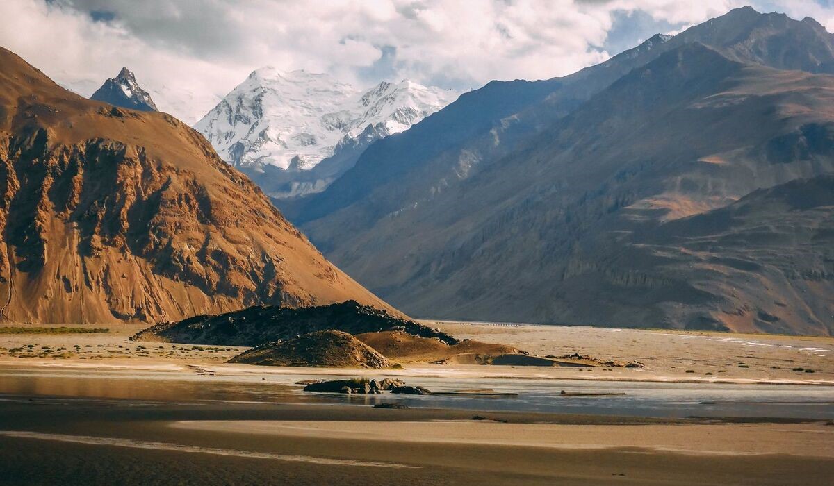
Mountains cover near 95% of the Kyrgyzstan territory and 40% of those are above 3,000 meters high. There are many regions where the foot of climber has never stepped. In Kyrgyzstan usual well explored regions where are high vertical walls over 1000 meters or peaks over 5,000 meters of altitude. Nevertheless thousands of accessible and gorgeous summits are still virgin.
There are 7 well known and explored mountainous regions in Kyrgyzstan. Four of them are located in Tien-Shan and three are in Pamir. But no one knows how many unexplored or not very well studied regions there still are. Easy access and spectacular summits determine interest to a region and its development.
This Guidebook gives brief description and outline of well explored as well as undeveloped and prospective regions (characteristics of the region, location, season, climate, history of exploring and development, camps, access, climbing opportunities, rescue works, connectivity and formalities). The Guide also gives recommendations on logistics and supply of alpine expeditions and solution of necessary formalities.
Photography is the courtesy of Vladimir Komissarov, Pat Littlejohn, Adrian Nelhams, Adolf Shlunegger, Kerim Aktaev, Alexey Pototskii, Jason Sheldrake and Slava Miroshkin.
Short geographical info about Kyrgyz Mountains. By Vladimir Komissarov
Kyrgyzstan borders with Kazakhstan, Uzbekistan, Tajikistan and China. The Republic covers an area of 198 000 square kilometers. It stretches for 980 km from west to east and the widest stretch from north to south is 350 km. The lowest point is 550 m located in the very north of the country and the highest point of 7,439 m is Pobeda Peak. The average altitude is 2200 m. About 95% of the territory is mountains. Mountainous ranges alternate with intermountain depressions, basins and valleys. There are three big basins: Chuiskaya, Issikkulskaya and Ferganskaya. Smaller basins are called intermountain depressions. These are Talasskaya, Narynskaya, Alaiskaya, Susamyrskaya, Djumgalskaya, Ketmen-Tubinskaya, Kochkorskaya, Atbashinskaya and Sonkulskaya basins. There are even smaller formations as intermountain valleys, such as Sarydjakskaya, Kuiluu, Inilchekskaya, etc. Mountainous ranges condensate and accumulate moisture. They form vertical zoning of physiographic structure, distribution of vegetation, climate and other characteristics.
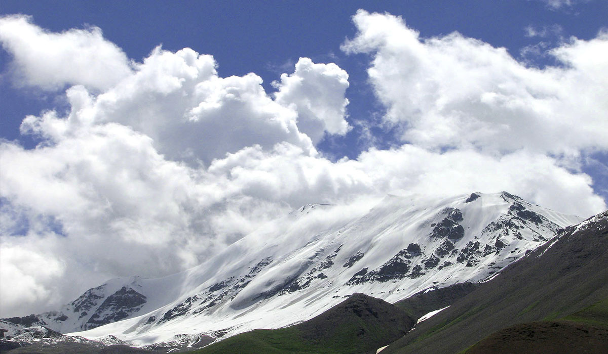
The climate of Kyrgyzstan is acutely continental. It is conditioned by remoteness from the ocean, elevation above sea level and location in the central part of the Eurasian continent. Such climate is characterized by significant temperature fluctuation both diurnal and seasonal, moderate precipitation and high dryness of air. Mountainous areas of Kyrgyzstan vary in local climate characteristics which determine diverse landscapes. Temperature distribution is influenced basically by the true altitude and relief ruggedness. The temperature is mostly influenced by the altitude in summer and by relief features in winter time. The latitude effects temperature insignificantly. Population of the country is 5 million people and most of people live in towns and villages situated in large valleys. Mountains of Kyrgyzstan are part of the two biggest mountainous systems in the world – the Tien-Shan and Pamir.

Ranges and places most interesting for mountaineering, ski mountaineering (+ski touring, free riding) and rock climbing
1. The Central Tien-Shan Ranges
1.1. Kokshaal Range, East part
1.2. Tengritag Range
1.3. Kayindy Range
1.4. Inylchekiy Range
1.5. Sarydjaz Range
1.6. Adyrtor Range
2. Terskey Range
3. Kyrgyz Range
4. West Kokshaal Range
5. Akshyirak Range
6. Kuilu Range
7. Borkoldoy Range
8. Atbashy Range
9. Jetym & Jetymbel Ranges
10. Torugart Range
11. Jangart Range
12. Janyjer Range
13. Zaalay Range
14. Turkestan Range
15. Alay Range
15.1. Kichik Alay Range
15.2. Kyrgyz-Ata Range
16. Alayku Range
17. Fergana Range
18. Suusamyr Range
19 Suek Range
20 Talas Range
21. Kunghey Range
I. East part of Kyrgyz Range N slope
II. Suusamyr Valley and round mountains
III. West part of Terskey Range
IV. Chon Kemin Valley, N slope of Kunghey Range
V. Kichi Kemin Valley
VI. Naryntoo Range
VII. Janyjer Range N slope
VIII. Atbashy Range N slope
IX. Jetym & Jetymbel
X. Suek Range
XI. Akshyirak Range
XII.Mushketov & Semionov Glaciers area
A. Ala-Archa and Chonkurchak Vallys of Kyrgyz Range
B. Canions of Sonkul Lake area
C. West part of N slope of Atbashy Range
D. West part of S slope of Janyjer Range
E. East part of N slope of Alay Range
F. West part of Turkestan Range
Tien-Shan
It is one of the mightiest mountainous systems in Asia. Its latitudinal strike is up to 2,000 km and its width is around 400 km. About two-third of the Tien-Shan mountains are located on the territory of Kyrgyzstan. Mountainous ridges of Tien-Shan stretch in latitudinal and sub latitudinal directions (appendix 1, figure 1). They are metamorphic and igneous rocks formed by sedimentary.
Orography
The orographic structure of the Tien-Shan is divided into the Northern, Western, Central, Inner and Eastern parts. The Northern Tien-Shan consists of Kyrgyzskii, Zailiiskii and Kungei-Ala-Too ranges. The Central Tien-Shan includes Eastern part of the Terskey Ala-Too and Kokshal Ranges, as well as Sarydjaz, Tengri-Tag, Meridionalnyi, Inylchekskyi and Kaindy Ranges. The Western Tien-Shan covers Talasskyi, Pskemskyi, Ugamskyi, Sandalashskyi and Chatkalskyi Ranges. The Inner Tien-Shan is situated to the South of Kyrgyzskyi and Terskey Ranges, to the East of Ferganskyi Range, to the North of Kokshaal Range and to the west of meridional part of Sarydjaz River. The Eastern Tien-Shan is located on the territory of China to the east of Meridional Range. The ridges of Tien-Shan are characterized by the latitudinal strike and there are a few differs only. Ferganskyi and Atoinokskyi Ranges are among the listed above, which stretch from the Northwest to the Southeast; the Meridional Range which has meridional strike; and the Pskemskyi, Ugamskyi, Chatkalskyi and Sandalashskyi Ranges stretching from the Southwest to the Northeast. The majority of ranges have typical mountainous glacial relief, so-called “alpine”. Insignificant number of ranges has high elevated ancient aligned areas – peneplains, like in Tibet. Examples of such peneplains can be elevated up to 4,000-5,000 meters, like the southern slope of Terskey Ala-Too or the Inner Tien- Shan. The acutely continental climate is characterized by hot summer in foothills and valleys and by cool and cold summer in highlands as well as rigorous winters; important daily and annual variation in temperature; light cloudiness and significant dryness of the air. The sun shines for 2,500-2,700 hours per year. The heaviest clouds are in March-April and lightest are in August-September. Vertical temperature gradient – when temperature drops every 100 meters of elevation – is 0.7°C in summer, 0.6°C in autumn and spring and 0.5°C in winter. Annual precipitation is irregular and usually is between 200-300 and 1,600 millimeters. The maximum precipitation falls out during the first part of summer. Surrounding mountainous ranges of Issik-Kul Lake form peculiar micro climate in the area. Landscape, climate, altitude of the snow line, vegetation and fauna of various regions of the Tien – Shan varies significantly. Total area of glaciers at the Kyrgyz part of the Tien-Shan is about 6580 kmІ, which is almost 3.65% of the total area of territory of the country. It includes 700 big and small glaciers. Big part of glaciations of the Kyrgyz Tien-Shan is located in the eastern part including the Central Tien-Shan and Terskey, Akshiirak, Kuiluu and Western Kokshaaltoo ranges. The largest glacier is the Southern Inylchek, which stretches for 62 km. It is the third longest mountainous glacier in the world after the Baltoro glacier (Karakorum) in Pakistan and the Fedchenko glacier (Pamir) in Tajikistan. The widest place of the Southern Inylchek is 3 km and thickness of the ice reaches 200 meters.
Pamir
The very Тorthern part of Pamir only belongs to Kyrgyzstan. It includes the northern slopes of the Zaalaiskii Range and the north of Pamir-Alai, including the Turkestanskyi and Alaiskyi ranges. This part of the Pamir is characterized by latitudinal strike. The climate of the Pamir as well as of the Tien-Shan is acutely continental but different in relative weather stability, less air humidity and bigger number of sunny days. Likewise, the heaviest clouds are in March-April and lightest are in August-September. The mountains of Pamir are composed with metamorphic, magmatic and sedimentary rocks. As a rule, central line consists of magmatic rocks which are superseded by metamorphic rocks toward the periphery and eventually by sedimentary ones.

